With my focus on pole shift catastrophes, I have repeatedly described the tsunamis and other effects of a sudden shift of the Earth’s surface over the core. But I was recently sent a link to a fascinating article about sea level changes that would occur in the very unlikely hypothetical event that Earth’s rotation slowly and gradually came to a halt. Ignoring the climate disaster that would be caused by the end of the day and night cycle – only Earth’s orbit around the sun would make it appear to move across the sky in six months of relentless sunshine followed by six months of freezing darkness…. what would happen to sea level?
Earth’s magnetic field probably contributed to the planet’s rotation, which after billions of years has led to an equatorial bulge with a polar radius some 21.4 kilometers shorter than at the equator. If this ended, centrifugal forces would disappear with rotation, and with only gravity remaining Earth’s surface would tend to shift back towards a more perfect sphere. But our planet’s semi-solid mantle would be much slower to redistribute than the oceans. In other words, at the speed of warm candle wax drooping over when the air conditioning fails on a very hot day – the interior of the Earth would very slowly shift to a more spherical shape. But the water in the oceans would level out immediately, moving from the equator to the poles.
As described here by Esri’s Witold Fraczek: “Sea level is—and has always been—in equilibrium with the planet’s gravity, which pulls the water toward the earth’s center of mass, and the outward centrifugal force, which results from the earth’s rotation. After a few billion years of spinning, the earth has taken on the shape of an ellipsoid (which can be thought of as a flattened sphere). Consequently, the distance to the earth’s center of mass is the longest around the equator and shortest beyond the polar circles. The current difference between the average sea level as observed along the equator and the distance to the earth’s center of mass from the sea level at the poles is about 21.4 kilometers (km).”
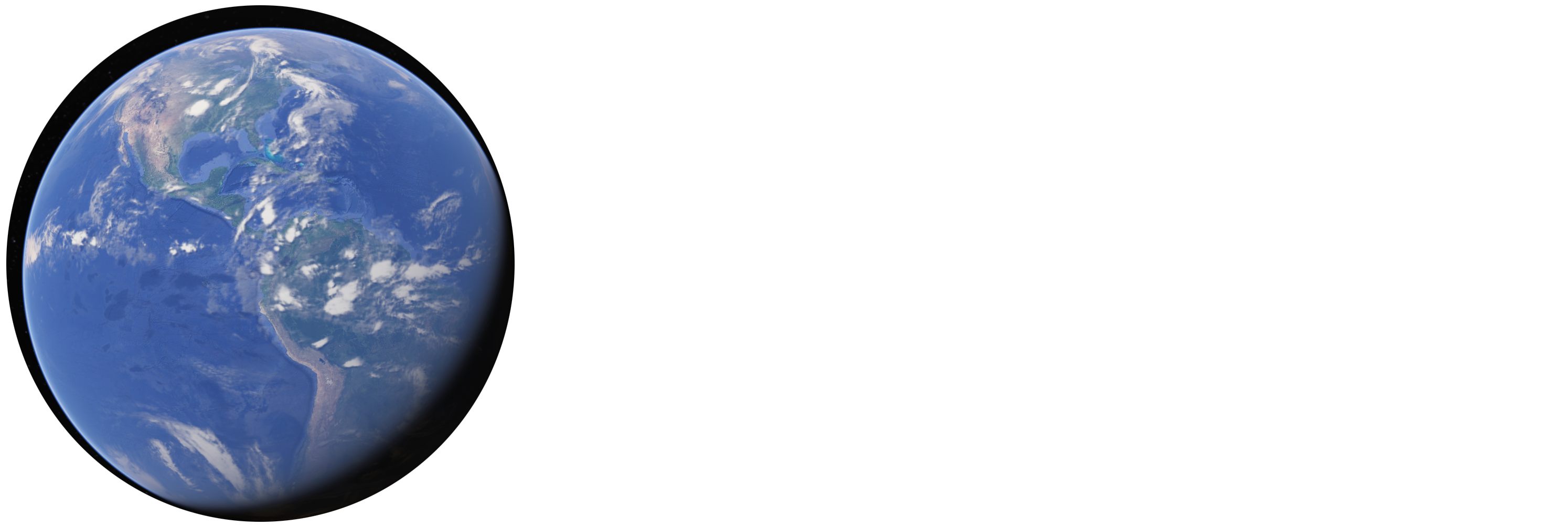
Earth as it is today with normal sea level:

“What would happen if the earth’s rotation slowed down and finally stopped spinning over a period of a few decades? ArcGIS lets us model the effects of this scenario, performing calculations and estimations and creating a series of maps showing the effects the absence of centrifugal force would have on sea level.
If earth ceased rotating about its axis but continued revolving around the sun and its axis of rotation maintained the same inclination, the length of a year would remain the same, but a day would last as long as a year. In this fictitious scenario, the sequential disappearance of centrifugal force would cause a catastrophic change in climate and disastrous geologic adjustments (expressed as devastating earthquakes) to the transforming equipotential gravitational state.
The lack of the centrifugal effect would result in the gravity of the earth being the only significant force controlling the extent of the oceans…. If the earth’s gravity alone was responsible for creating a new geography, the huge bulge of oceanic water—which is now about 8 km high at the equator—would migrate to where a stationary earth’s gravity would be the strongest…. “If the earth stood still, the oceans would gradually migrate toward the poles and cause land in the equatorial region to emerge. This would eventually result in a huge equatorial megacontinent and two large polar oceans.”
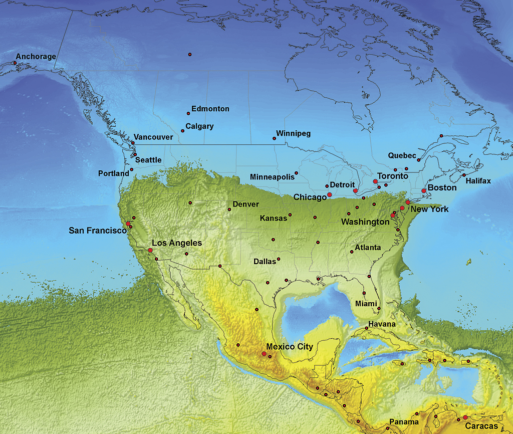
“Due to the unique relief of the earth’s surface at the beginning of the slowdown, the most significant changes to the outline of land versus water would occur at the high latitudes of the northern hemisphere where the swell ocean would quickly expand over the flat and vast territories of northern Siberia and northern Canada.” (Below is an image of North America midway through the changes.)
“The line that delineates the areas that hydrologically contribute to one or the other ocean would follow the equator if the earth was a perfect ellipsoid. However, due to the significant relief of both the continents and the ocean floor, the hypothetical global divide between the areas that hydrologically contribute to one or another ocean deviates from the equator significantly. Analogous to the well-known U.S. Continental Divide, this would be the border separating two giant hemispherical watersheds of the new circumpolar oceans….
The highest elevation of the global divide in the Colombian Andes would be about 12,280 meters, whereas the altitudes of the famous equatorial volcanoes of Chimborazo (Ecuador) and Kilimanjaro (Tanzania) would be 13,615 and 12,786 meters, respectively. Both volcanoes happen not to be located on the global divide line. The lowest point on the new global dividing line, with an elevation of 2,760 meters, would be situated southwest of Kiribati Island in the western Pacific.” (I think what he means here is that the location where the last connection remains between the northern and southern oceans before they separate would be in what is today a “relatively” shallow part of the Pacific Ocean. Even that point moves above sea level and would end up 2,760 meters above the final sea level. If human civilization survived such changes – there would be no chance of building a Panama-canal style connection across the equatorial megacontinent. Earth’s highest peaks would be over 8 miles high, and even the low point a transcontinental canal would have to cross would still have an altitude of 1.7 miles.)
“Today, all three world oceans are connected. This creates a global ocean with basically one sea level. As a consequence of rotational slowdown, the outline of the global ocean would continuously undergo dramatic changes. Equatorial waters would move toward polar areas, initially causing a significant reduction in depth while filling the polar basins that have much less capacity. As regions at high latitude in the northern hemisphere become submerged, the areal extent of the northern circumpolar ocean would rapidly expand, covering the vast lowlands of Siberia and northern portions of North America. The global ocean would remain one unit until the rotation of the earth decreased to the speed at which ocean separation would occur. The interaction between the inertia of huge water bodies and decreasing centrifugal force would be very complicated. As the consequence of steady slowdown of earth’s rotation, the global ocean would be gradually separated into two oceans. Obviously, the last connection will be broken at the lowest point of the global divide line, located southwest of the Kiribati Islands. Since the current western Pacific Ocean is a plane, land would emerge quickly because there would be no chance that water would be exchanged between the two circumpolar oceans after the initial split. The area of final separation between the two oceans would be the simultaneous emerging and drying of territory extending for hundreds of kilometers.”

Depicted above: About half way through the changes, Russia would end up entirely submerged, as would most of Canada and Europe. The United States, from New York south, would briefly remain above the new sea level. Huge new lands would rise from the seafloor, especially north of Australia, west of Ecuador, and between India and Madagascar. Except for Antarctica, little land has been lost in the Southern Hemisphere at this point. Unfortunately for life on Earth, the image above isn’t the final surface arrangement of land and sea. Note the oceans are still quite connected.
“The slowdown would continue after the separation of the two oceans and cause further migration of the ocean water toward the poles. Surprisingly (despite Antarctica’s elevation), the southern polar basin has a larger capacity than the northern one. Given the fixed volume of water in both hemispheres, the more capacious basin of the southern pole would result in an overall lower sea level than the northern ocean. According to volumetric calculation performed with the ArcGIS 3D Analyst extension, the difference between the sea level of the two oceans should be 1,407 meters. However, the data accuracy does not warrant this level of precision, so the elevation difference between the sea level of the two oceans used was 1,400 meters.”

By this point more land has been lost in Argentina, Tasmania and New Zealand – along with more of Asia, Europe, and the United States submerging under the Northern Ocean. New continent-sized lands have emerged in what were once the Pacific, Atlantic, and Indian Oceans – merging the remaining lands into the aforementioned equatorial megacontinent.
I enjoy looking at maps, both of the Earth we know and of alternative future Earth as it might look after a pole shift has pushed continents to new latitudes again. Some of the concepts described above would be slightly relevant even in a 30 degree pole shift – for example if North America moves south again like it did almost 13,000 years ago, ending the “ice age” (in North America, anyway) and shifting the North Pole from where it had been in Hudson Bay to its present position. I thought Placzek’s article was interesting, especially with the hypothetical maps. Check it out. Consider subscribing to my blog if you enjoyed this article. Or if you want to know more about what might really happen to change Earth’s future surface conditions in our lifetime (many scientists say the next pole shift is due before 2050) consider reading
POLE SHIFT: Evidence Will Not Be Silenced