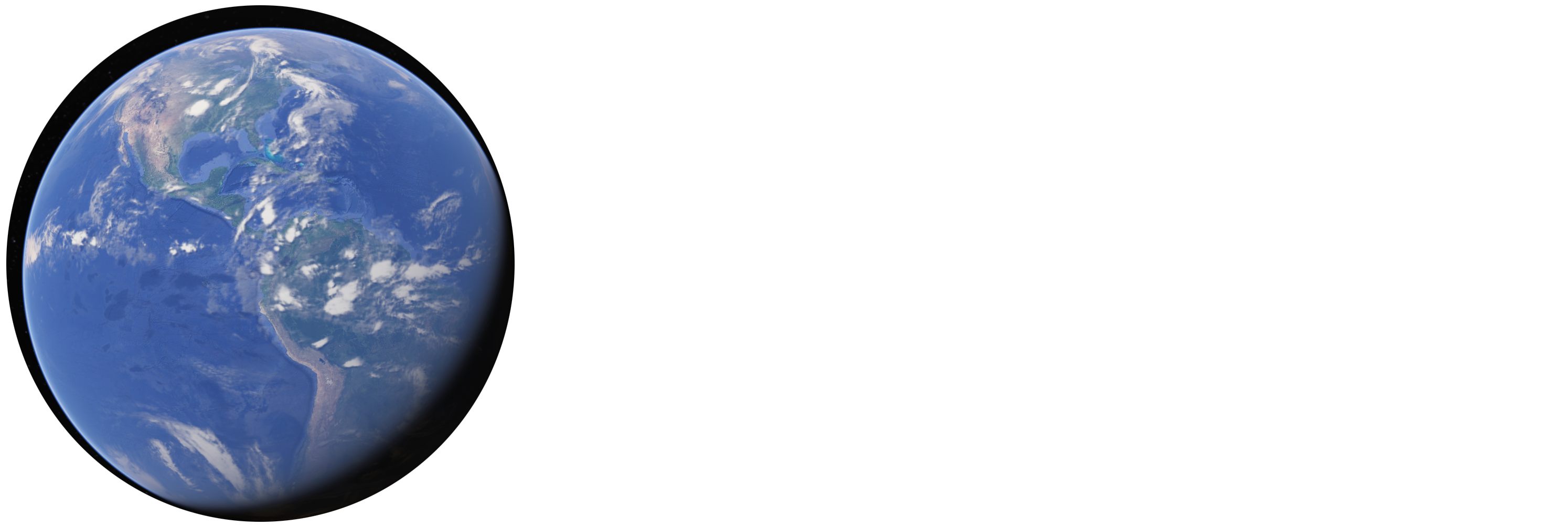
There’s a new spike in interest in POLE SHIFTS after a lot of Youtube videos in the last few weeks started commenting on a “new navy map” that isn’t really new and isn’t really from the U.S. Navy. There are a lot of maps based on estimates of what would happen if polar ice all melted or what would happen if the Earth’s crust slips over the core and a pole shift creates a new arrangement of the planet’s surface, with all the continents at different latitudes and elevations, and new locations for the poles, the equator, and everything in between.
It’s all guesswork, but it’s pretty cool to look at. Consider these pics from a video just based on all the ice melting:
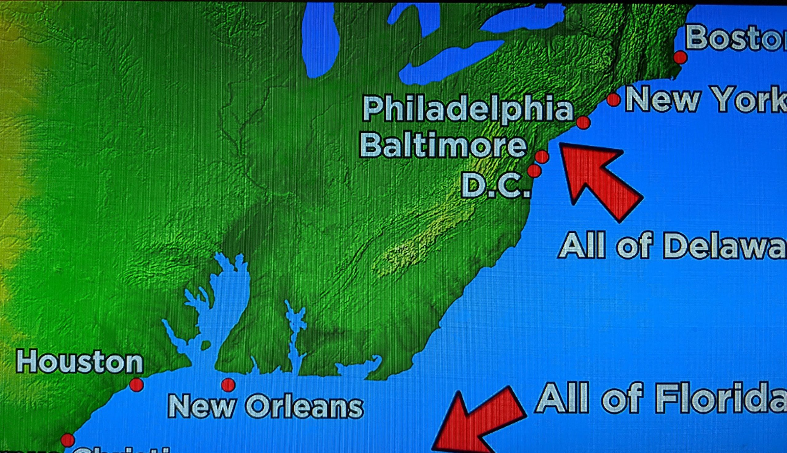
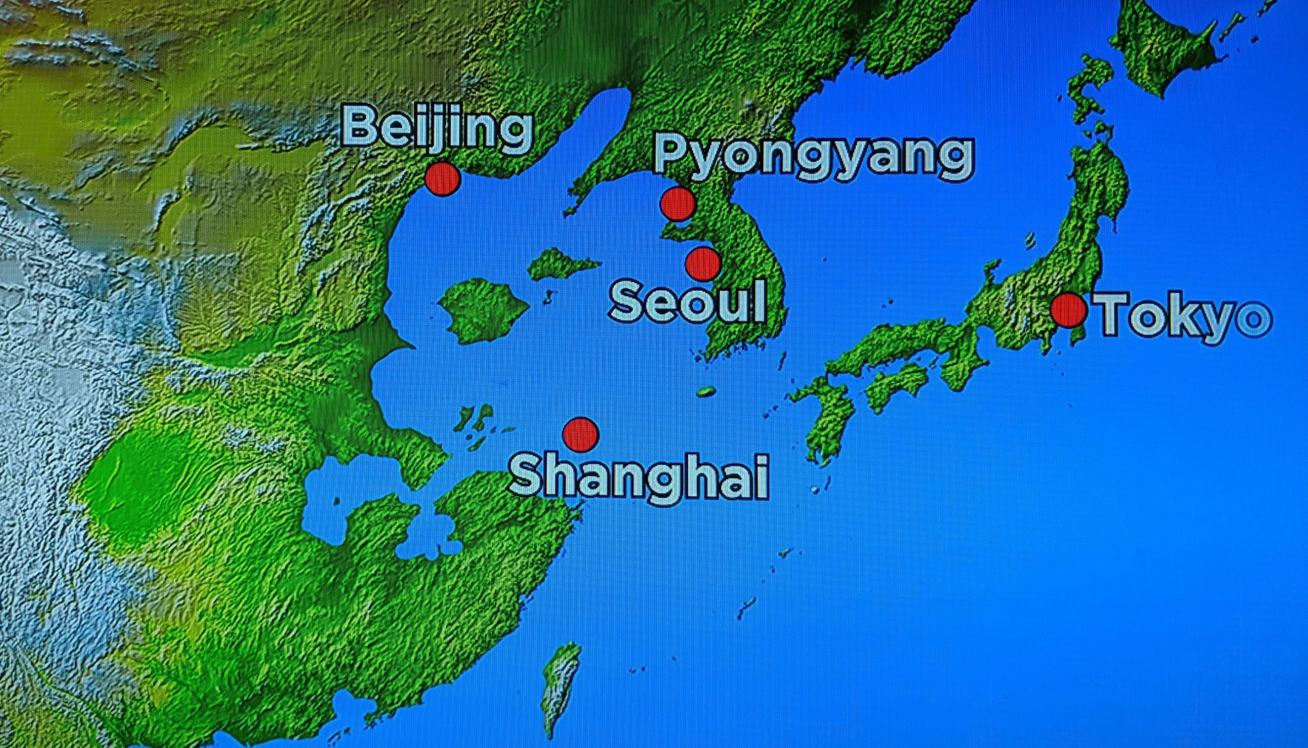
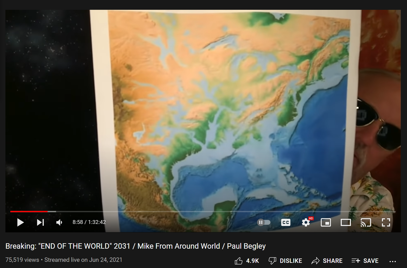
More recently Pastor Paul Begley made several videos highlighting a map he got from “Mike From Around the World” and this map of the eastern United States also shows many areas submerged and is allegedly based on the U.S. Navy’s expectations of a worst case climate change scenario in the near future:
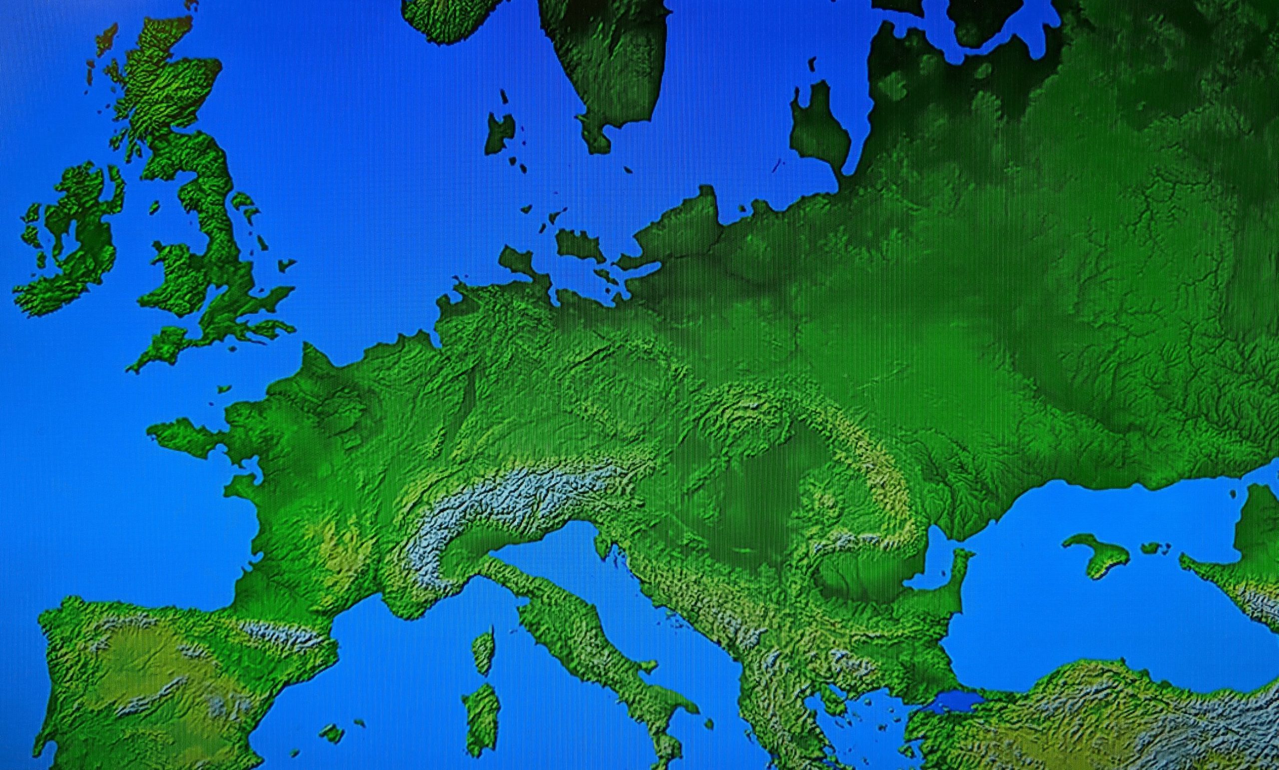
Next, imagine the far greater catastrophe of a POLE SHIFT – in which the entire crust of the planet moves as one solid piece over the core, shifting mass imbalances like the accumulated ice sheets of Greenland and Antarctica to the equator after cosmic electromagnetic field changes induce a solar outburst and the Earth is affected on many levels…. Well explained and documented by Ben Davidson in many videos on his SuspiciousObservers channel on Youtube.
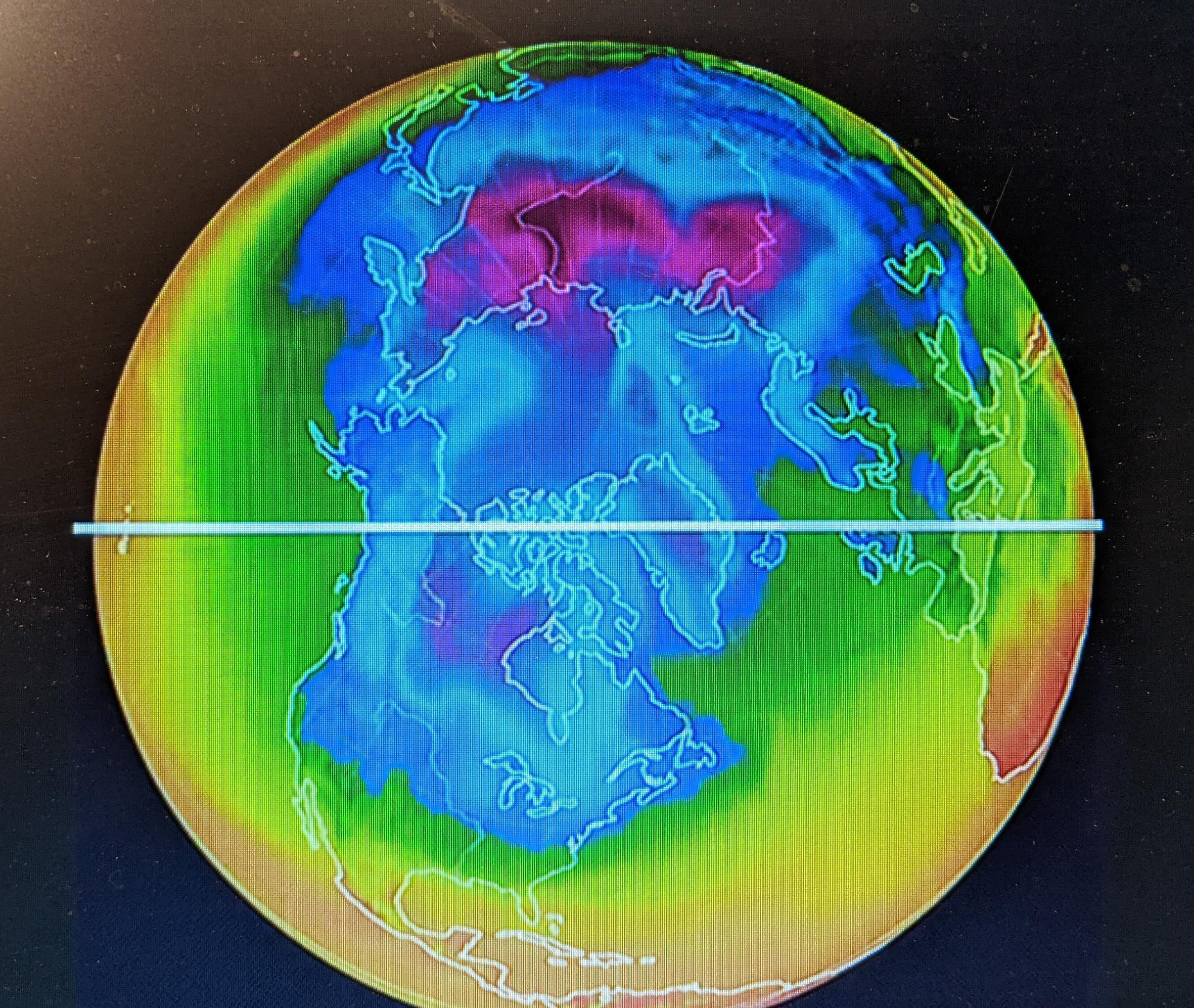
Ben Davidson’s map above only shows the new positions of the continents if the massive ice caps of Antarctica and Greenland are re-balanced and allowed to shift to the equator. No changes in elevation – no submergence of existing lands – or rising of old ones – is depicted above. But it may very well show the future equator. Chan Thomas, author of The Adam and Eve story and the subject of my next book, predicted that the upcoming pole shift will see the new North Pole in the Bay of Bengal, and that is where our magnetic poles seem to be moving to a convergence point – the magnetic poles are currently on a collision course towards the Bay of Bengal. (And Chan Thomas is not the only pole shift researcher who expected that position for the next North Pole.) If this happens, southeast Asia will be under one of the next ice caps, along with Peru, as the new South Pole would end up just west of Peru. But before those new ice caps grow, the old ones we have known will be melting rapidly in the equatorial sunshine. I often wonder what newly habitable lands will emerge, and what evidence may yet be found of previous civilizations….
Different analysts have different expectations based on the evidence of past pole shifts and current terrestrial, solar, and galactic ongoing changes. If you want a deeper look at the evidence, consider reading some good pole shift books like POLE SHIFT: Evidence Will Not Be Silenced – and several others found here.